Swiss Topographic Registry • 2026 Edition
CH-COORD: 46°49'06"N 8°13'39"E / FED. STATUS: ALL SECTORS OPERATIONAL
Alpine Valleys • Scenic Rail Corridors • Glacial Basins

Switzerland's Definitive Alpine Topography & Lake Vistas

An objective, field-verified index documenting Switzerland's most celebrated geography. We evaluate transit connectivity, summit elevations, lake navigation, and seasonal conditions across five core regional destinations.

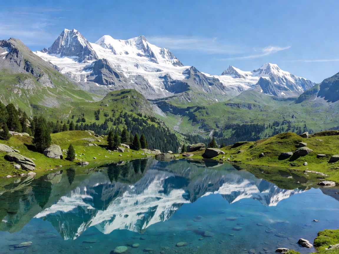
Panoramic view of Swiss Alpine mountain range and crystal lake
■ High-Alpine Telemetry
3,883 m Max Cable Terminal
48% Grade Steepest Cogwheel
5
Regional Hubs Analyzed in depth
72
Waterfalls Lauterbrunnen Valley
4,478 m
Matterhorn Summit Valais glacier cirque
100%
Clock-Face Rail Synchronized SBB corridors
Core Territory Documentation

Documented Alpine Destinations

Structured operational metrics for each alpine hub, including base elevations, cantonal rail links, key summits, and valley topography.

Elevation 436 m
Canton Lucerne
Water Body Lake Lucerne
Key Peak Mt Pilatus
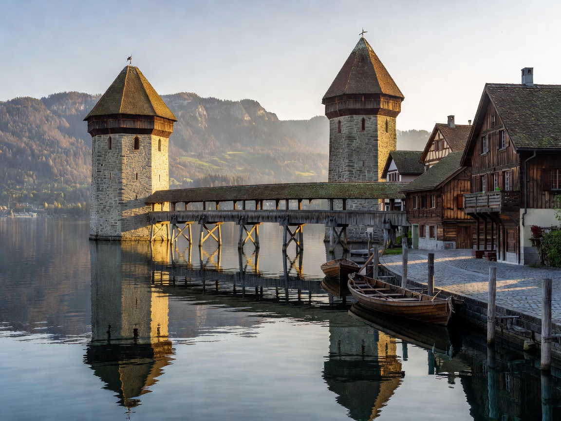
Lake Lucerne historic waterfront and medieval bridge towers

Lucerne: Lake Panorama & Historic Mountain Ramps

Positioned on Lake Lucerne with direct cogwheel access to Mount Pilatus and Mount Rigi. Lucerne combines medieval river preservation with central Switzerland's most connected railway interchange.

Transit Hub • Central CH View Analysis →
Elevation 1,608 m
Canton Valais
Access Car-Free Rail
Key Peak Matterhorn
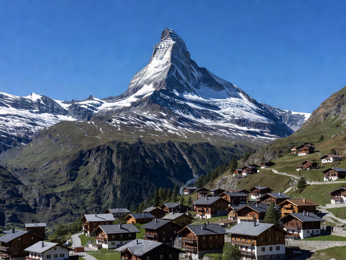
The iconic pyramid horn of the Matterhorn rising over Zermatt

Zermatt: High Alpine Isolation & The Matterhorn

Tucked at the terminus of the Matter Valley beneath the 4,478-metre Matterhorn. A car-free alpine settlement served by the Gornergrat Bahn and high-altitude glacier tramways.

Glacier Basin • Southern Alps View Analysis →
Elevation 795 m
Canton Bern
Features 72 Waterfalls
Key Peak Jungfrau Base
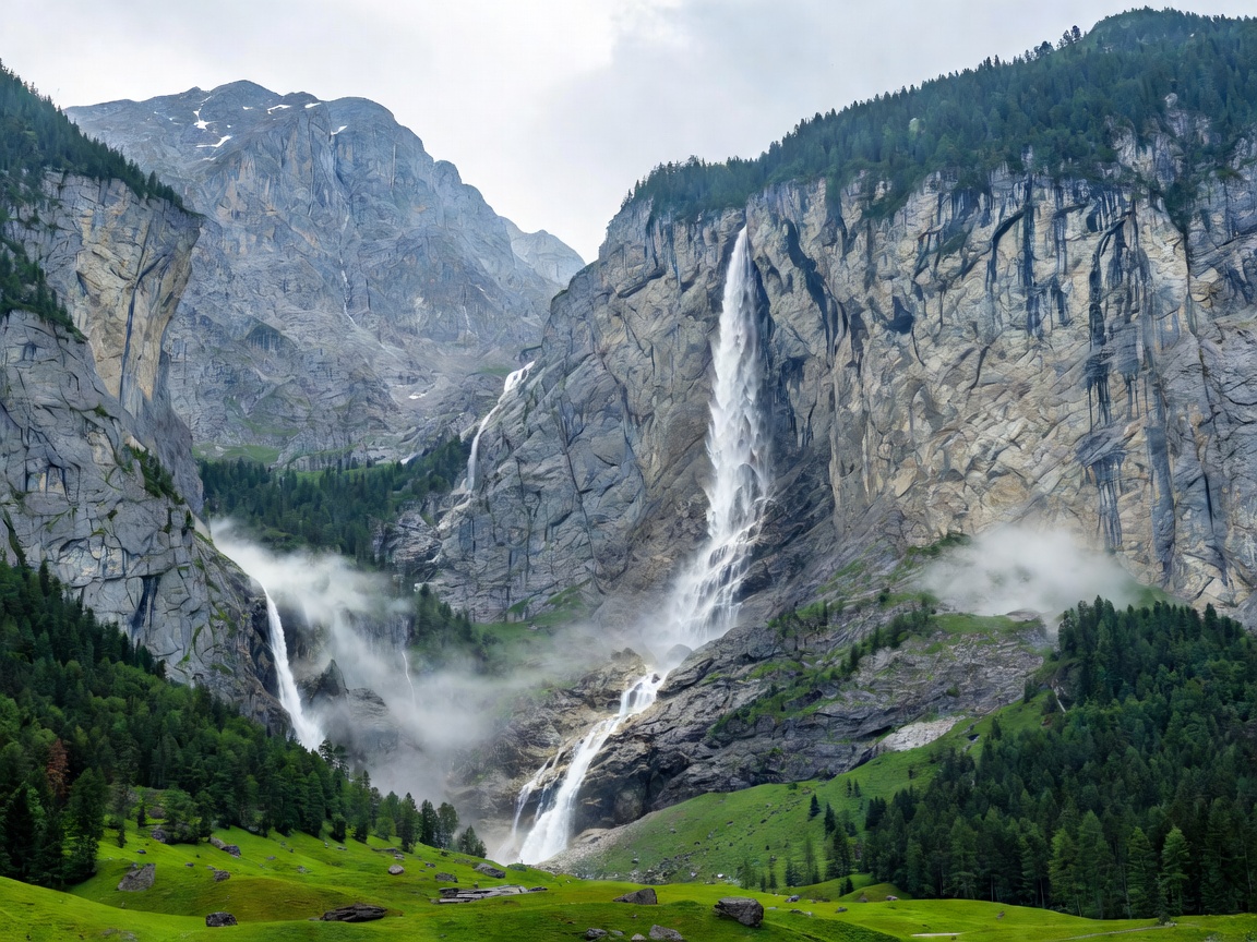
Steep vertical limestone cliffs and cascading falls of Lauterbrunnen

Lauterbrunnen: Glacial U-Valley & Vertical Cascades

A classic glacial trough bounded by 300-metre vertical rock faces and 72 waterfalls, including the subterranean Trümmelbach cascades and Staubbach Falls.

Bernese Oberland • Canyon View Analysis →
Elevation 566 m
Canton Bern
Lakes Thun & Brienz
Key Peak Harder Kulm
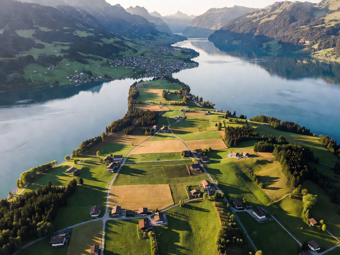
Aerial perspective over the Bödeli plain between Lake Thun and Lake Brienz

Interlaken: The Alluvial Isthmus & Jungfrau Staging

Situated upon the alluvial plain between Lake Thun and Lake Brienz. Interlaken functions as the central logistical terminal for expeditions into the Eiger, Mönch, and Jungfrau massifs.

Lakeside Plain • Adventure Rail View Analysis →
Elevation 390 m
Canton Vaud
Water Body Lake Geneva
Key Peak Rochers de Naye
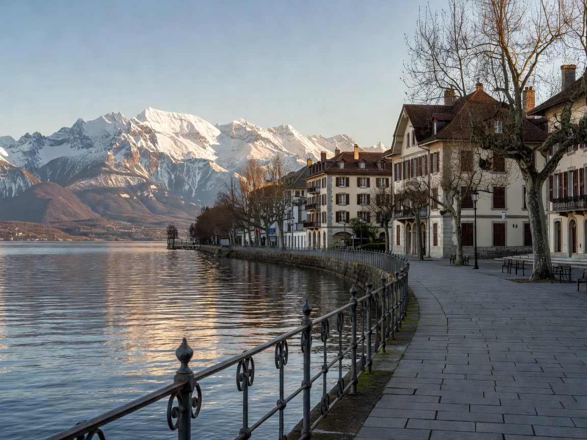
Lake Geneva shoreline promenade at Montreux with snowcapped Dents du Midi in background

Montreux: Lake Geneva Microclimate & Lavaux Terraces

Sheltered along the eastern rim of Lake Geneva, Montreux delivers a sub-Mediterranean microclimate backed by the UNESCO Lavaux terraced vineyards and medieval Chillon Castle.

Swiss Riviera • Vaudois View Analysis →
Evaluation Framework

Operational Planning for Swiss Alpine Travel

Planning journeys through high-altitude Swiss topography requires balancing weather variance, elevation acclimation, and integrated rail timetables. Consider these fundamental regional dynamics:

01

Integrated Transport (SBB)

Switzerland's national rail system coordinates train, funicular, postal bus, and passenger ferry connections on precise clock-face timetables, eliminating reliance on road vehicles.

02

Elevation & Cloud Ceilings

Valley temperatures can sit at 22°C while mountain stations at 3,000 metres drop below freezing with strong wind chills. Real-time webcam validation remains essential prior to summit cable ascent.

03

Seasonal Transit Windows

High alpine hiking routes above 2,000 metres typically clear of heavy snowpack only by late June, whereas lowland lake navigation lines operate extensive schedules from April through October.